
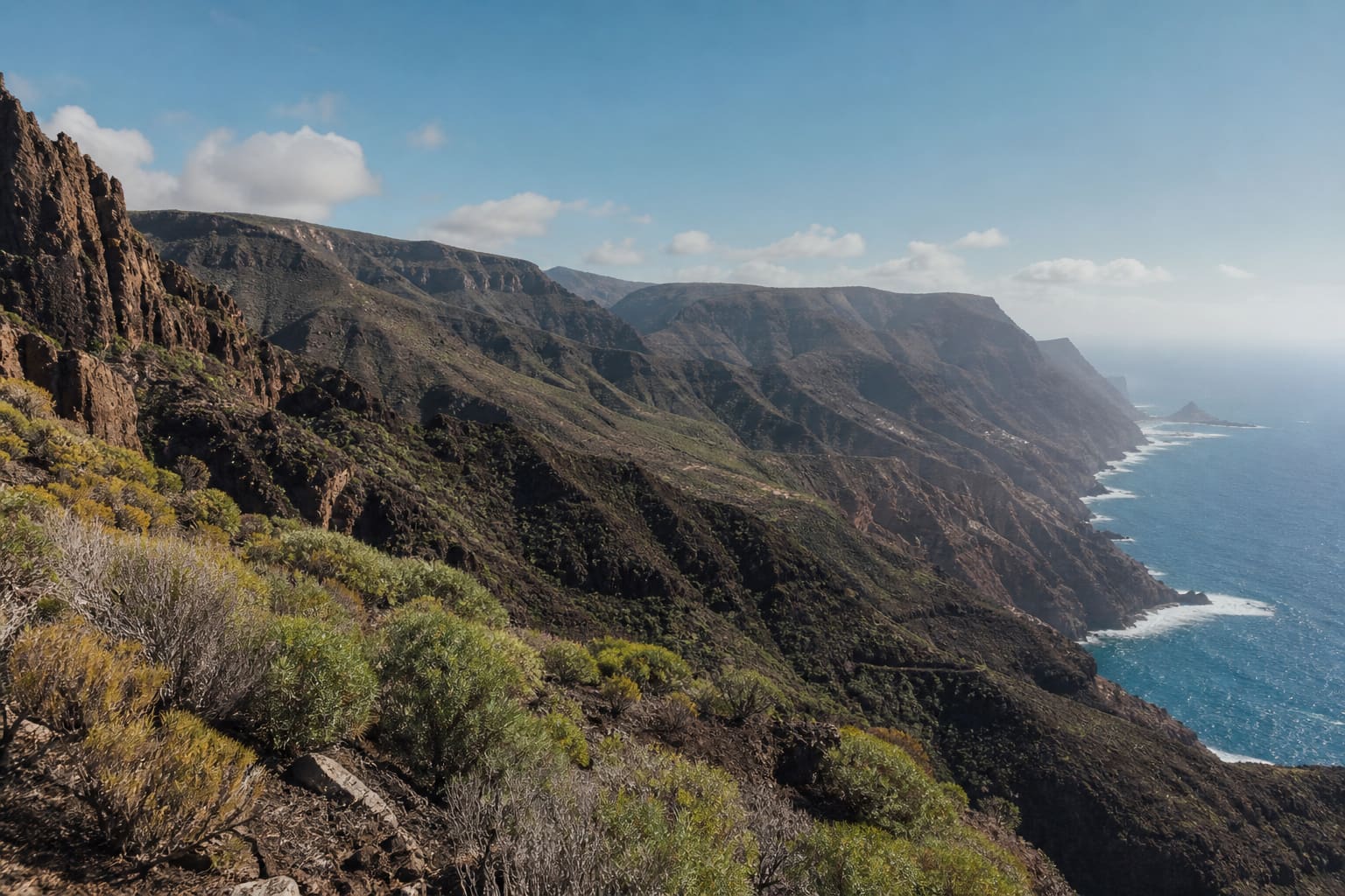
THE OVERVIEW
Treat Galápagos as a tightly regulated protected archipelago, choosing a land-based or vessel-led format according to mobility, sea tolerance and conservation impact rather than prestige. Puerto Ayora, Santa Cruz: Broad services, research access and central connections. Baltra arrival requires bus, ferry and road stages. Puerto Baquerizo Moreno, San Cristóbal: Easy airport access and local wildlife sites. Fewer inter-island and high-end options than Santa Cruz. Puerto Villamil, Isabela: Small-town pace and volcanic landscapes. Boat transfers can be rough and medical infrastructure is limited.
YEAR AT A GLANCE
The weather rhythm in Galápagos Islands.
Climate averages, not a forecast. Current conditions still need checking before travel.
- Jan26.1° / 23°69.5 mm rain
- Feb27.4° / 24°137.9 mm rain
- Mar28° / 24.4°147.3 mm rain
- Apr27.4° / 24°154.4 mm rain
- May26.2° / 23.3°49.4 mm rain
- Jun24.8° / 22.1°20.2 mm rain
- Jul23.7° / 21°12 mm rain
- Aug22.9° / 20.1°8.9 mm rain
- Sep22.8° / 19.9°5.9 mm rain
- Oct23.2° / 20°5.6 mm rain
- Nov23.8° / 20.6°10 mm rain
- Dec24.8° / 21.7°37.8 mm rain
Average daily high, low and rainfall: Open-Meteo Historical Weather API, ERA5-Land, Galápagos destination coordinates (-0.9538, -90.9656), 1991 to 2020
area
Puerto Ayora, Santa Cruz
Broad services, research access and central connections
Broad services, research access and central connections
Details should be checked for your travel dates.area
Puerto Baquerizo Moreno, San Cristóbal
Easy airport access and local wildlife sites
Easy airport access and local wildlife sites
Details should be checked for your travel dates.area
Puerto Villamil, Isabela
Small-town pace and volcanic landscapes
Small-town pace and volcanic landscapes
Details should be checked for your travel dates.experience
Charles Darwin Research Station
Planning note
Research and breeding programmes provide essential context for conservation interventions.
Details should be checked for your travel dates.experience
Tortuga Bay
Planning note
A protected beach and mangrove landscape reachable from Puerto Ayora.
Details should be checked for your travel dates.experience
San Cristóbal Interpretation Centre
Planning note
A strong introduction to settlement, ecology and resource pressures before field visits.
Details should be checked for your travel dates.experience
Isabela wetlands and tortoise centre
Planning note
Boardwalks connect mangroves, birdlife and conservation work close to Puerto Villamil.
Details should be checked for your travel dates.experience
Naturalist-guided marine excursion
Planning note
Choose an authorised operator and site suited to season, swimming ability and sea conditions.
Details should be checked for your travel dates.station
Seymour Airport, Baltra
airport
Arrival for Santa Cruz requires airport bus, channel ferry and onward road transfer with luggage.
Details should be checked for your travel dates.station
San Cristóbal Airport
airport
The airport is close to Puerto Baquerizo Moreno and simplifies land-based arrival.
Details should be checked for your travel dates.travel_advice
Galápagos Islands climate normals
Verified 1991 to 2020 monthly averages
Open-Meteo historical data at the destination coordinates show average daily highs from 22.8°C to 28°C and lows from 19.9°C to 24.4°C across the year.
Details should be checked for your travel dates.travel_advice
Choosing the time to go
Seasonal planning
December to May is warmer with generally calmer seas and intermittent rain. June to November is cooler and drier with rougher water. Wildlife patterns vary by island and month; no season offers every species or activity.
Details should be checked for your travel dates.travel_advice
Plan the complete route
Access and practical detail
Request exact room, bathroom, transfer and attraction access details in writing. Altitude, heat, humidity, road conditions or sea state may be more limiting than nominal distance. Keep operational checks live and avoid critical same-day connections after complex transfers.
Details should be checked for your travel dates.travel_advice
Current travel guidance
Keep official advice date-specific
Recheck entry, health, security, regional warnings and transport disruption before travel.
Details should be checked for your travel dates.STAY
Hotels to consider
A considered starting point, not a statement of availability or a booking recommendation.
Finch Bay Galapagos Hotel
Low-rise waterfront hotel
Galapagos Islands, Ecuador
For a land-based programme with organised excursions and no central road traffic.
Arrival requires a short water taxi and sandy or uneven approaches.Golden Bay Galapagos
Waterfront island hotel
Galapagos Islands, Ecuador
For airport simplicity and immediate access to the San Cristóbal waterfront.
Some excursions still require small-boat boarding and wet landings.Scalesia Galapagos Lodge
Small highland lodge
Galapagos Islands, Ecuador
For a quieter ecological stay beyond Puerto Villamil.
Remote access, paths and transfers make this unsuitable for some mobility needs.ORIENTATION
A sense of place
Every marker uses coordinates supplied by the published Desk guide.
AT A GLANCE
Practical notes
- Typical stay
- Choose a land-based or vessel-led journey first, then match the islands and excursions to sea tolerance, mobility and conservation rules. Extra island changes add boats, flights and weather exposure.
- When to consider
- December to May is warmer with generally calmer seas and intermittent rain. June to November is cooler and drier with rougher water. Wildlife patterns vary by island and month; no season offers every species or activity.
- Climate
- Open-Meteo historical data at the destination coordinates provide a complete 1991 to 2020 series. Average daily highs range from 22.8°C to 28°C and lows from 19.9°C to 24.4°C. These are climate averages, not a forecast.
- Getting around
- Seymour Airport, Baltra: Arrival for Santa Cruz requires airport bus, channel ferry and onward road transfer with luggage. San Cristóbal Airport: The airport is close to Puerto Baquerizo Moreno and simplifies land-based arrival.
- Worth preparing for
- Request exact room, bathroom, transfer and attraction access details in writing. Altitude, heat, humidity, road conditions or sea state may be more limiting than nominal distance. Keep operational checks live and avoid critical same-day connections after complex transfers. Recheck entry, health, security, regional warnings and transport disruption before travel.
Sources and credits
- Galápagos Islands official tourism · Official tourism authority
- Finch Bay Galapagos Hotel official website · Finch Bay Galapagos Hotel
- Golden Bay Galapagos official website · Golden Bay Galapagos
- Scalesia Galapagos Lodge official website · Scalesia Galapagos Lodge
- Charles Darwin Research Station official information · Charles Darwin Research Station
- Tortuga Bay official information · Tortuga Bay
- Seymour Airport, Baltra official information · Seymour Airport, Baltra
- San Cristóbal Airport official information · San Cristóbal Airport
- Ecuador travel advice · UK FCDO
- Open-Meteo 1991 to 2020 climate series · Open-Meteo · Open-Meteo Historical Weather API at the destination coordinates; complete 1991 to 2020 daily maximum, minimum and precipitation series aggregated by calendar month
Guide last reviewed 27 September 2026.