
THE OVERVIEW
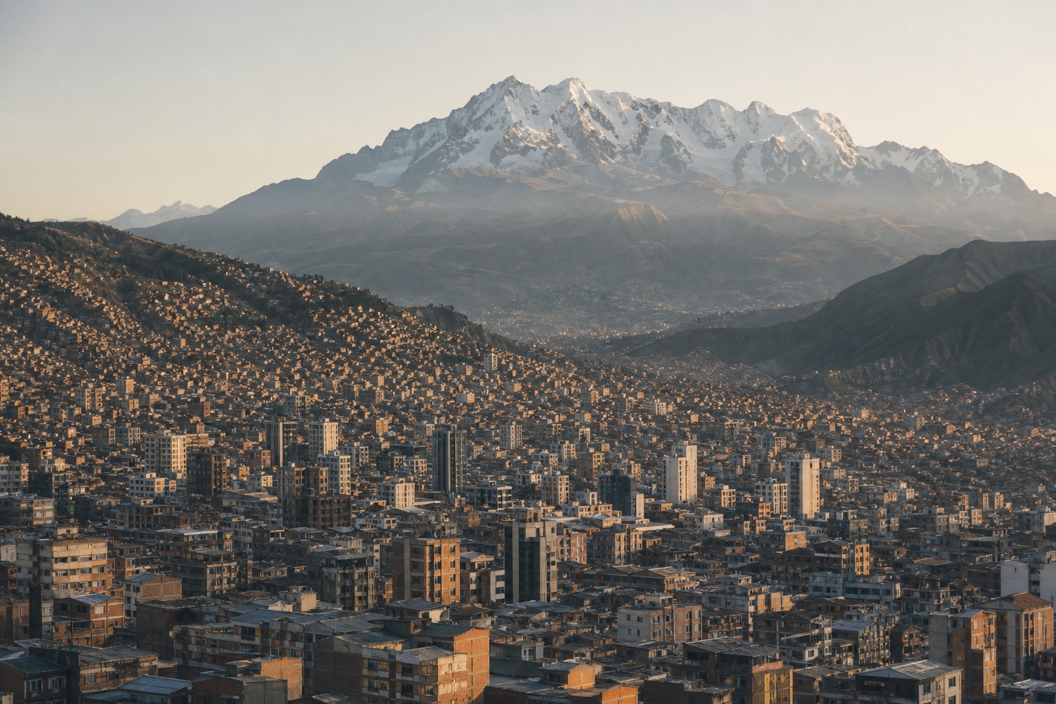
Approach La Paz and El Alto as a connected high-altitude metropolis shaped by Aymara culture, markets, political history and remarkable public transport. Centro and San Francisco: Museums, markets and historic streets. Steep gradients, crowds and security care Sopocachi: Restaurants, galleries and central hotels. Hills and recent security cautions Zona Sur: Lower altitude and broader facilities. Longer journey to central sites El Alto: Aymara urban culture, markets and views. Altitude, crowds and guided planning essential
YEAR AT A GLANCE
The weather rhythm in La Paz.
Climate averages, not a forecast. Current conditions still need checking before travel.
- Jan15° / 4.1°131.9 mm rain
- Feb14.8° / 4°104.8 mm rain
- Mar14.9° / 3.8°78.3 mm rain
- Apr14.9° / 2.6°33.6 mm rain
- May14.8° / 0°11.3 mm rain
- Jun14° / -1.2°9.1 mm rain
- Jul13.8° / -1.8°11.6 mm rain
- Aug14.5° / -0.9°18.9 mm rain
- Sep15.2° / 1.1°23.8 mm rain
- Oct15.9° / 2.9°45.9 mm rain
- Nov16.5° / 3.4°48.3 mm rain
- Dec15.7° / 4.1°96.6 mm rain
Average daily high, low and rainfall: NASA POWER Daily API, La Paz destination coordinates (-16.4897, -68.1193), 1991 to 2020
area
Centro and San Francisco
Museums, markets and historic streets
Museums, markets and historic streets
Details should be checked for your travel dates.area
Sopocachi
Restaurants, galleries and central hotels
Restaurants, galleries and central hotels
Details should be checked for your travel dates.area
Zona Sur
Lower altitude and broader facilities
Lower altitude and broader facilities
Details should be checked for your travel dates.area
El Alto
Aymara urban culture, markets and views
Aymara urban culture, markets and views
Details should be checked for your travel dates.experience
Mi Teleférico network
Planning note
Use several lines as public transport and as a geographic lesson linking La Paz with El Alto.
Details should be checked for your travel dates.experience
El Alto with a specialist local guide
Planning note
Markets, architecture and Aymara civic life deserve informed, non-extractive interpretation.
Details should be checked for your travel dates.experience
Valle de la Luna
Planning note
A short geological stop shows the eroded landscape south of the city.
Details should be checked for your travel dates.station
El Alto International Airport
airport
Arrival is above 4,000 metres; plan rest, hydration and a supported transfer.
Details should be checked for your travel dates.travel_advice
La Paz climate normals
Verified 1991 to 2020 monthly averages
NASA POWER's complete 1991 to 2020 daily series at La Paz's canonical coordinate shows average daily highs from 13.8°C to 16.5°C, lows from -1.8°C to 4.1°C and average monthly rainfall from 9.1 mm to 131.9 mm. These are historical gridded estimates, not a forecast.
Details should be checked for your travel dates.travel_advice
Choosing the time to go
Seasonal planning
May to October is generally drier, with strong sun and cold nights. The wetter summer can disrupt roads. Altitude is the dominant practical factor year-round.
Details should be checked for your travel dates.travel_advice
Plan the complete route
Access and practical detail
Confirm exact room, bathroom, vehicle and attraction access before booking. Use local security and weather advice for daily routing. Protect transfer time and avoid promising wildlife, weather, access or transport performance.
Details should be checked for your travel dates.travel_advice
Current travel guidance
Keep official advice date-specific
Recheck entry, health, security, regional warnings and disruption before travel.
Details should be checked for your travel dates.STAY
Hotels to consider
A considered starting point, not a statement of availability or a booking recommendation.
Atix Hotel
Considered editorial option
La Paz, Bolivia
A contemporary lower-altitude base with Bolivian art.
It is distant from central museums.ORIENTATION
A sense of place
Every marker uses coordinates supplied by the published Desk guide.
AT A GLANCE
Practical notes
- Typical stay
- Shape the stay around a coherent route and the required transfer time.
- When to consider
- May to October is generally drier, with strong sun and cold nights. The wetter summer can disrupt roads. Altitude is the dominant practical factor year-round.
- Climate
- NASA POWER historical data at the destination coordinates provide a complete 1991 to 2020 daily series aggregated into 12 calendar-month normals. Average daily highs range from 13.8°C to 16.5°C, lows from -1.8°C to 4.1°C and average monthly rainfall from 9.1 mm to 131.9 mm. These are historical gridded estimates, not a forecast.
- Getting around
- El Alto International Airport: Arrival is above 4,000 metres; plan rest, hydration and a supported transfer.
- Worth preparing for
- Confirm exact room, bathroom, vehicle and attraction access before booking. Use local security and weather advice for daily routing. Protect transfer time and avoid promising wildlife, weather, access or transport performance. Recheck entry, health, security, regional warnings and disruption before travel.
Sources and credits
- La Paz official tourism · Official tourism authority
- Atix Hotel official website · Atix Hotel
- Mi Teleférico network official information · Mi Teleférico network
- El Alto International Airport official information · El Alto International Airport
- bolivia travel advice · UK FCDO
- NASA POWER daily climate series, 1991 to 2020 · NASA POWER · NASA POWER daily gridded estimates at the destination coordinates; complete 1991 to 2020 daily maximum, minimum and corrected precipitation series aggregated into 12 calendar-month normals; raw response checksum e42135cc36b189e732ae1839de0d292c3fc07128ef449a544f54460a7f8b9b0e verified 2026-09-22
Guide last reviewed 22 September 2026.