
THE OVERVIEW
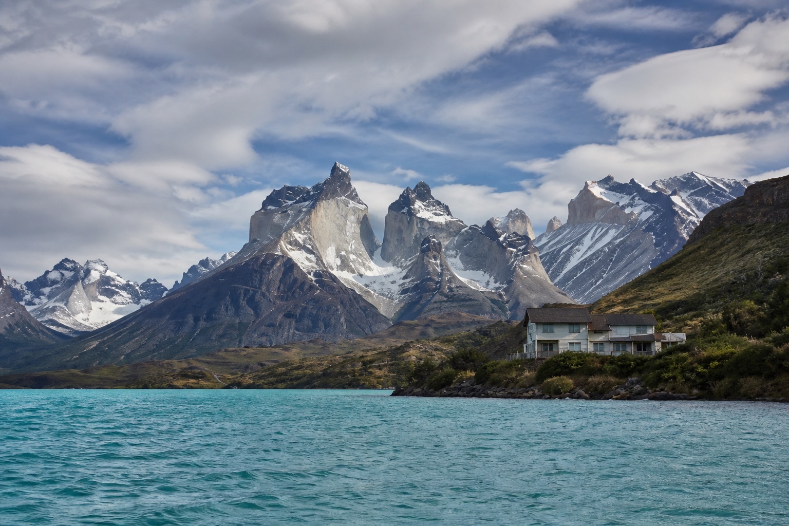
Treat Patagonia as a vast cross-border region requiring a focused route, long buffers and honest discussion of wind, wilderness access, conservation and Indigenous histories. El Calafate and Los Glaciares: Glacier access and practical air gateway. Wind, distance and seasonal operations Torres del Paine and Puerto Natales: Mountain landscapes and varied day routes. Permit, weather and rough-path constraints Bariloche and the Lakes: Forests, food and year-round infrastructure. Busy summer and winter road conditions Ushuaia and Tierra del Fuego: Maritime history and southern ecology. Flight disruption and expedition pressure
YEAR AT A GLANCE
The weather rhythm in Patagonia.
Climate averages, not a forecast. Current conditions still need checking before travel.
- Jan15.3° / 4.4°28 mm rain
- Feb15.8° / 4.5°27.1 mm rain
- Mar12.9° / 3.1°35.7 mm rain
- Apr8.7° / 1°45.2 mm rain
- May4.5° / -1.4°62.2 mm rain
- Jun1° / -4.7°63.9 mm rain
- Jul0.4° / -5.8°53.6 mm rain
- Aug2.2° / -3.9°49.7 mm rain
- Sep5.1° / -2°35 mm rain
- Oct8.6° / -0.2°39.5 mm rain
- Nov11.4° / 1.4°34.7 mm rain
- Dec13.7° / 3.2°31.3 mm rain
Average daily high, low and rainfall: NASA POWER Daily API, Patagonia destination coordinates (-46.5, -72), 1991 to 2020
area
El Calafate and Los Glaciares
Glacier access and practical air gateway
Glacier access and practical air gateway
Details should be checked for your travel dates.area
Torres del Paine and Puerto Natales
Mountain landscapes and varied day routes
Mountain landscapes and varied day routes
Details should be checked for your travel dates.area
Bariloche and the Lakes
Forests, food and year-round infrastructure
Forests, food and year-round infrastructure
Details should be checked for your travel dates.area
Ushuaia and Tierra del Fuego
Maritime history and southern ecology
Maritime history and southern ecology
Details should be checked for your travel dates.experience
Perito Moreno Glacier viewpoints
Planning note
The boardwalk system offers an unusually broad range of glacier views without requiring an ice trek.
Details should be checked for your travel dates.experience
Torres del Paine scenic day route
Planning note
Use vehicle-accessible viewpoints and short walks to interpret geology, conservation and tourism pressure.
Details should be checked for your travel dates.experience
Tierra del Fuego National Park
Planning note
Choose a guided route addressing peatlands, forests, Yaghan histories and border landscapes.
Details should be checked for your travel dates.experience
Punta Arenas and Strait of Magellan
Planning note
Museums and waterfront interpretation connect maritime trade, migration and Indigenous dispossession.
Details should be checked for your travel dates.station
Comandante Armando Tola International Airport
airport
Primary gateway for El Calafate and Los Glaciares.
Details should be checked for your travel dates.station
Ushuaia International Airport
airport
Useful for Tierra del Fuego; wind can affect operations.
Details should be checked for your travel dates.travel_advice
Patagonia climate normals
Verified 1991 to 2020 monthly averages
NASA POWER's complete 1991 to 2020 daily series at Patagonia's canonical coordinate shows average daily highs from 0.4°C to 15.8°C, lows from -5.8°C to 4.5°C and average monthly rainfall from 27.1 mm to 63.9 mm. These are historical gridded estimates, not a forecast.
Details should be checked for your travel dates.travel_advice
Choosing the time to go
Seasonal planning
Austral summer, roughly November to March, offers longer days but strong wind and high demand. Shoulder seasons can be rewarding with reduced services. Winter needs specialist driving and weather planning.
Details should be checked for your travel dates.travel_advice
Plan the complete route
Access and practical detail
Confirm exact room, bathroom, vehicle and attraction access before booking. Use local security and weather advice for daily routing. Protect transfer time and avoid promising wildlife, weather, access or transport performance.
Details should be checked for your travel dates.travel_advice
Current travel guidance
Keep official advice date-specific
Recheck entry, health, security, regional warnings and disruption before travel.
Details should be checked for your travel dates.STAY
Hotels to consider
A considered starting point, not a statement of availability or a booking recommendation.
EOLO Patagonia’s Spirit
Considered editorial option
Patagonia
A remote estancia-style base for landscape interpretation and a slower stay.
Remote roads and outdoor terrain require careful access checks.Explora Torres del Paine
Considered editorial option
Patagonia
A park-based option with guided routes of differing intensity.
Remote access, weather and vehicle transfers remain limiting.Las Balsas
Considered editorial option
Patagonia
A small lakeside base for the northern Patagonian lakes.
Split levels and lakeshore terrain need confirmation.ORIENTATION
A sense of place
Every marker uses coordinates supplied by the published Desk guide.
AT A GLANCE
Practical notes
- Typical stay
- Shape the stay around a coherent route and the required transfer time.
- When to consider
- Austral summer, roughly November to March, offers longer days but strong wind and high demand. Shoulder seasons can be rewarding with reduced services. Winter needs specialist driving and weather planning.
- Climate
- NASA POWER historical data at the destination coordinates provide a complete 1991 to 2020 daily series aggregated into 12 calendar-month normals. Average daily highs range from 0.4°C to 15.8°C, lows from -5.8°C to 4.5°C and average monthly rainfall from 27.1 mm to 63.9 mm. These are historical gridded estimates, not a forecast.
- Getting around
- Comandante Armando Tola International Airport: Primary gateway for El Calafate and Los Glaciares. Presidente Carlos Ibáñez del Campo Airport: Main Chilean gateway for Punta Arenas and Torres del Paine road transfers. Ushuaia International Airport: Useful for Tierra del Fuego; wind can affect operations.
- Worth preparing for
- Confirm exact room, bathroom, vehicle and attraction access before booking. Use local security and weather advice for daily routing. Protect transfer time and avoid promising wildlife, weather, access or transport performance. Recheck entry, health, security, regional warnings and disruption before travel.
Sources and credits
- Patagonia official tourism · Official tourism authority
- EOLO Patagonia’s Spirit official website · EOLO Patagonia’s Spirit
- Explora Torres del Paine official website · Explora Torres del Paine
- Las Balsas official website · Las Balsas
- Perito Moreno Glacier viewpoints official information · Perito Moreno Glacier viewpoints
- Torres del Paine scenic day route official information · Torres del Paine scenic day route
- Tierra del Fuego National Park official information · Tierra del Fuego National Park
- Punta Arenas and Strait of Magellan official information · Punta Arenas and Strait of Magellan
- Comandante Armando Tola International Airport official information · Comandante Armando Tola International Airport
- Ushuaia International Airport official information · Ushuaia International Airport
- argentina travel advice · UK FCDO
- chile travel advice · UK FCDO
- NASA POWER daily climate series, 1991 to 2020 · NASA POWER · NASA POWER daily gridded estimates at the destination coordinates; complete 1991 to 2020 daily maximum, minimum and corrected precipitation series aggregated into 12 calendar-month normals; raw response checksum 54ddaa5c775cc650cba38648b67dcb40a0df0568968d96e763d539d3c92f0ac4 verified 2026-09-22
Guide last reviewed 23 September 2026.