
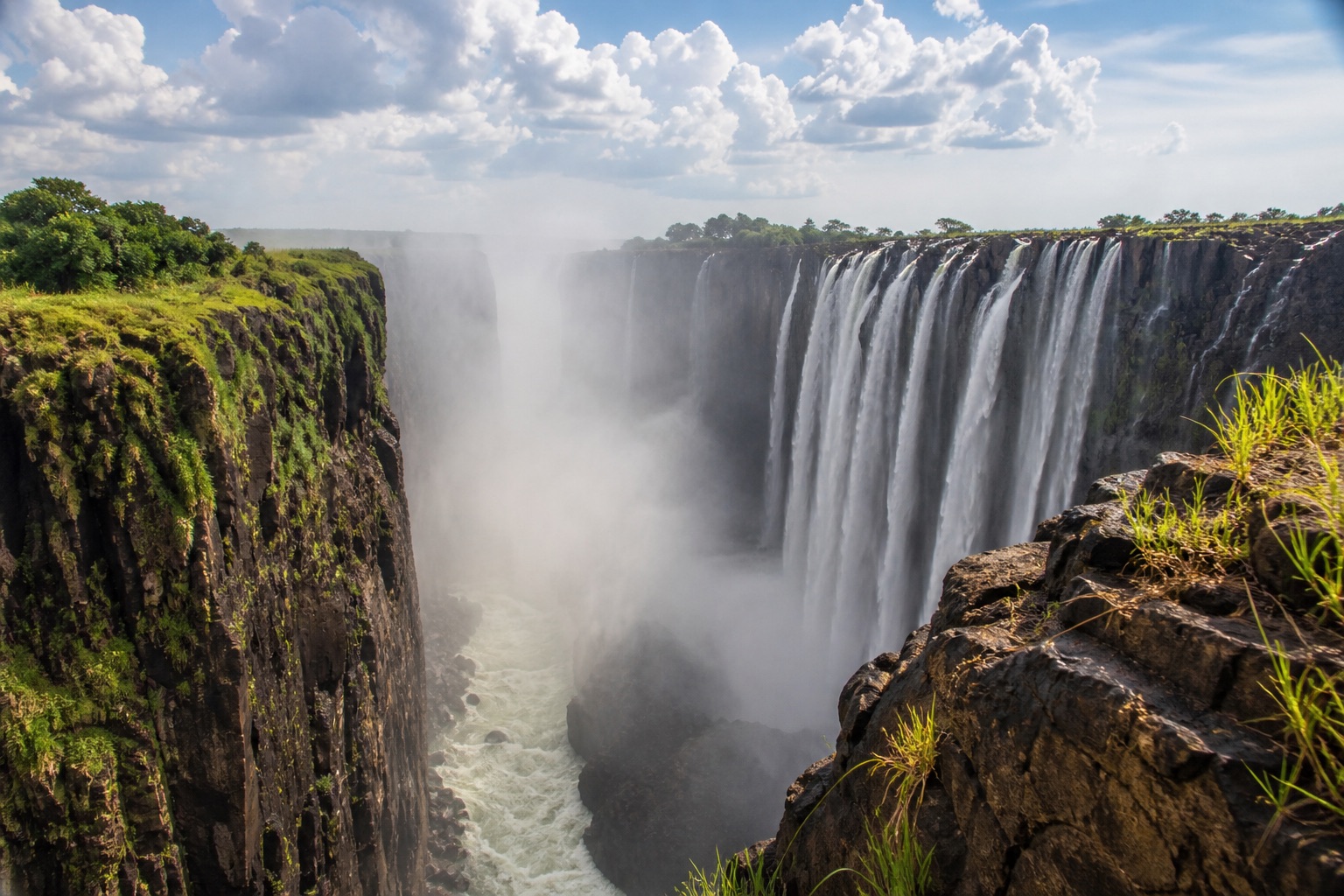
THE OVERVIEW
Build Victoria Falls as a transboundary river and conservation destination, matching water level, border logistics, wildlife ethics and physical access to the traveller rather than promising one fixed spectacle. Victoria Falls town, Zimbabwe: Broad hotel choice and main rainforest paths. Tourist pricing, wildlife in town and border queues. Livingstone, Zambia: Museums, local town life and Zambian falls access. Road transfer to the falls and seasonal viewpoints. Zambezi river lodges: Quieter nature setting and guided river activity. Isolation and reliance on lodge transport.
YEAR AT A GLANCE
The weather rhythm in Victoria Falls.
Climate averages, not a forecast. Current conditions still need checking before travel.
- Jan30.3° / 19.5°144.8 mm rain
- Feb29.8° / 19°123.5 mm rain
- Mar30.4° / 18.5°87.4 mm rain
- Apr30.1° / 16.1°26.2 mm rain
- May28.8° / 12.8°3.4 mm rain
- Jun26.3° / 10.1°4.2 mm rain
- Jul25.8° / 9.3°0.2 mm rain
- Aug29.6° / 12°0.1 mm rain
- Sep33.8° / 16.2°2.6 mm rain
- Oct36.1° / 19.9°12.3 mm rain
- Nov34.3° / 20.8°67.2 mm rain
- Dec31.4° / 20°129.4 mm rain
Average daily high, low and rainfall: NASA POWER Daily API, Victoria Falls destination coordinates (-17.9243, 25.8572), 1991 to 2020
area
Victoria Falls town, Zimbabwe
Broad hotel choice and main rainforest paths
Broad hotel choice and main rainforest paths
Details should be checked for your travel dates.area
Livingstone, Zambia
Museums, local town life and Zambian falls access
Museums, local town life and Zambian falls access
Details should be checked for your travel dates.area
Zambezi river lodges
Quieter nature setting and guided river activity
Quieter nature setting and guided river activity
Details should be checked for your travel dates.experience
Victoria Falls rainforest, Zimbabwe
Planning note
A guide can interpret geology, hydrology, ecology and local names rather than treating viewpoints as a photo circuit.
Details should be checked for your travel dates.experience
Mosi-oa-Tunya falls paths, Zambia
Planning note
The Zambian side offers different proximity and seasonal perspectives, including a dry-rock landscape at low water.
Details should be checked for your travel dates.experience
Ethical wildlife drive in Zambezi National Park
Planning note
Choose a licensed small operator and focus on ecosystem interpretation rather than guaranteed sightings.
Details should be checked for your travel dates.experience
Zambezi sunset or conservation-led river trip
Planning note
A small responsible operator can reveal river ecology and upstream geography.
Details should be checked for your travel dates.station
Victoria Falls International Airport
airport
The Zimbabwe gateway is about 20 km from town; arrange an accessible transfer and confirm border plans.
Details should be checked for your travel dates.station
Harry Mwanga Nkumbula International Airport
airport
The Livingstone gateway is on the Zambian side; cross-border stays need visa and vehicle checks.
Details should be checked for your travel dates.travel_advice
Victoria Falls climate normals
Verified 1991 to 2020 monthly averages
NASA POWER's complete 1991 to 2020 daily series at Victoria Falls's canonical coordinate shows average daily highs from 25.8°C to 36.1°C, lows from 9.3°C to 20.8°C and average monthly rainfall from 0.1 mm to 144.8 mm. These are historical gridded estimates, not a forecast.
Details should be checked for your travel dates.travel_advice
Choosing the time to go
Seasonal planning
Water is usually highest around March to May, producing heavy spray, while the Zambian side can be largely dry at low water around October and November. Heat, rain and wildlife conditions vary through the year.
Details should be checked for your travel dates.travel_advice
Plan the complete route
Access and practical detail
Arrange trusted transport and confirm the exact adapted room, vehicle and venue route. Heat, rain, traffic, rough surfaces and limited medical infrastructure materially affect suitability. For ferries, boats, wildlife vehicles and border crossings, obtain step-by-step operational details.
Details should be checked for your travel dates.travel_advice
Current travel guidance
Keep official advice date-specific
Recheck entry, health, security, regional warnings and transport disruption before travel. Check Zambia advice separately for any cross-border itinerary.
Details should be checked for your travel dates.STAY
Hotels to consider
A considered starting point, not a statement of availability or a booking recommendation.
Batonka Guest Lodge
Independent garden lodge
Victoria Falls
For calm, manageable scale and access to town without a large resort.
A taxi is useful for the falls entrance and some paths are garden-based.Ilala Lodge Hotel
Established full-service hotel
Victoria Falls
For walking proximity to the Zimbabwe falls entrance and comprehensive facilities.
Baboons and other wildlife require caution around open areas.Tongabezi Lodge
River lodge
Victoria Falls
For a quieter Zambian river stay and tailored guiding.
Remote, spread-out and dependent on road or boat transfers.ORIENTATION
A sense of place
Every marker uses coordinates supplied by the published Desk guide.
AT A GLANCE
Practical notes
- Typical stay
- Shape the stay around a coherent route and the required transfer time.
- When to consider
- Water is usually highest around March to May, producing heavy spray, while the Zambian side can be largely dry at low water around October and November. Heat, rain and wildlife conditions vary through the year.
- Climate
- NASA POWER historical data at the destination coordinates provide a complete 1991 to 2020 daily series aggregated into 12 calendar-month normals. Average daily highs range from 25.8°C to 36.1°C, lows from 9.3°C to 20.8°C and average monthly rainfall from 0.1 mm to 144.8 mm. These are historical gridded estimates, not a forecast.
- Getting around
- Victoria Falls International Airport: The Zimbabwe gateway is about 20 km from town; arrange an accessible transfer and confirm border plans. Harry Mwanga Nkumbula International Airport: The Livingstone gateway is on the Zambian side; cross-border stays need visa and vehicle checks.
- Worth preparing for
- Arrange trusted transport and confirm the exact adapted room, vehicle and venue route. Heat, rain, traffic, rough surfaces and limited medical infrastructure materially affect suitability. For ferries, boats, wildlife vehicles and border crossings, obtain step-by-step operational details. Recheck entry, health, security, regional warnings and transport disruption before travel. Check Zambia advice separately for any cross-border itinerary.
Sources and credits
- Victoria Falls official tourism · Official destination organisation
- Batonka Guest Lodge official website · Batonka Guest Lodge
- Ilala Lodge Hotel official website · Ilala Lodge Hotel
- Tongabezi Lodge official website · Tongabezi Lodge
- Victoria Falls rainforest, Zimbabwe official information · Victoria Falls rainforest, Zimbabwe
- Mosi-oa-Tunya falls paths, Zambia official information · Mosi-oa-Tunya falls paths, Zambia
- Zambezi sunset or conservation-led river trip official information · Zambezi sunset or conservation-led river trip
- Victoria Falls International Airport official information · Victoria Falls International Airport
- Harry Mwanga Nkumbula International Airport official information · Harry Mwanga Nkumbula International Airport
- Zimbabwe and Zambia travel advice · UK FCDO
- Zambia travel advice · UK FCDO
- NASA POWER daily climate series, 1991 to 2020 · NASA POWER · NASA POWER daily gridded estimates at the destination coordinates; complete 1991 to 2020 daily maximum, minimum and corrected precipitation series aggregated into 12 calendar-month normals; raw response checksum 1ca4ee22fa0e39fd67b77545a572a7523450344a1c9aa0a6ce876441936d4504 verified 2026-09-23
Guide last reviewed 23 September 2026.